
09 Apr On The Map: 2018-01
First, an introduction. My name is Michael McNeil and I’m currently the Geographic Information Systems Coordinator for the St. Tammany Parish Assessor’s Office.
I’ve been doing GIS work for more than 12 years now both in the private and public sectors all over the country. I graduated from Louisiana State University in 2006 with a Bachelor’s Degree in Geography, and currently am pursuing a Master’s Degree in Digital Mapping from the University of Kentucky.
This is my sixth year at the Assessor’s Office, and I’m incredibly honored to be a part of this special mapping project that will modernize the Assessor’s Office and provide a valuable application for all in St. Tammany Parish.
I’ll be compiling all of your valuable questions and feedback about our online parcel map for these regular updates so that the information can be disseminated to all who may be interested. You can email me here.
I’ll also include important GIS news from the Assessor’s Office in these updates, as well as tips for using the GIS services available to you via the online parcel map.
With the introduction out of the way, onto this month’s update!
PROGRESS REPORT
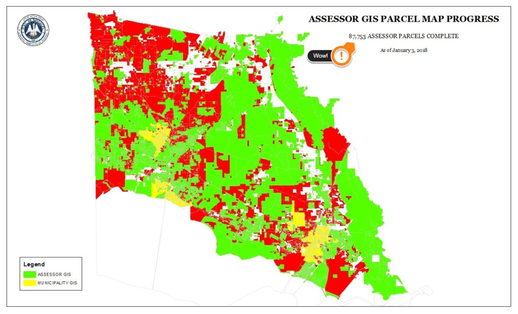
As of the start of 2018, we have 87,000+ ownership parcels geographically accounted for in the system. This number includes non-parcel data for the cities of Slidell, Mandeville, and Covington.
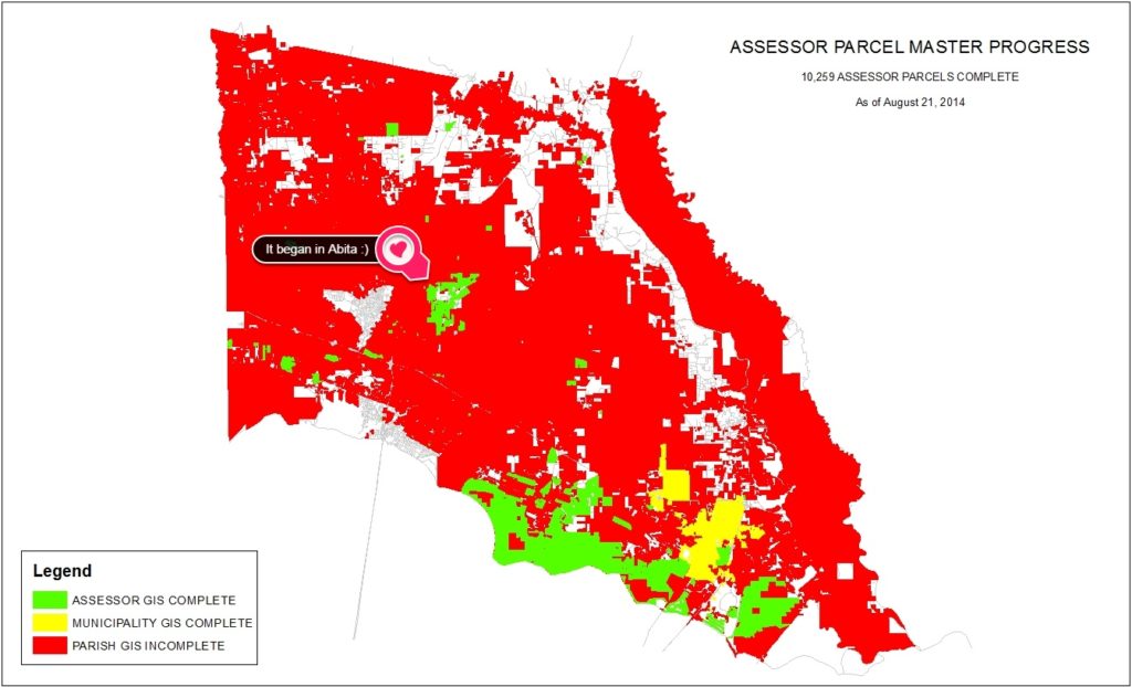
Not bad, considering where we were when we started these monthly progress updates way back in 2014:
So, crunching the numbers: 77,000 added since August 2014 / 40 months since then = 1,925 added per month!
GIS should therefore exceed 100,000 parcels easily by the end of 2018. And perhaps even 110,000 if that rate above is sustainable. As we move into more of the rural areas, that will be a challenge. But I believe that we are up for it.
This year will fly by … because it’s going to be a busy one!
IDENTIFYING PARCELS ON THE PUBLIC PARCEL MAP
We recently received a question about identifying parcels on the public map. When the user clicked on the map inside a parcel, nothing happened. No window popped up to display the detailed assessment information tied to the parcels.
This one is fairly straightforward but, frankly, a little bit of a shortcoming in the functionality of the website. In order to identify a parcel, you have to make sure the “Identify” tab is highlighted at the top of the screen:
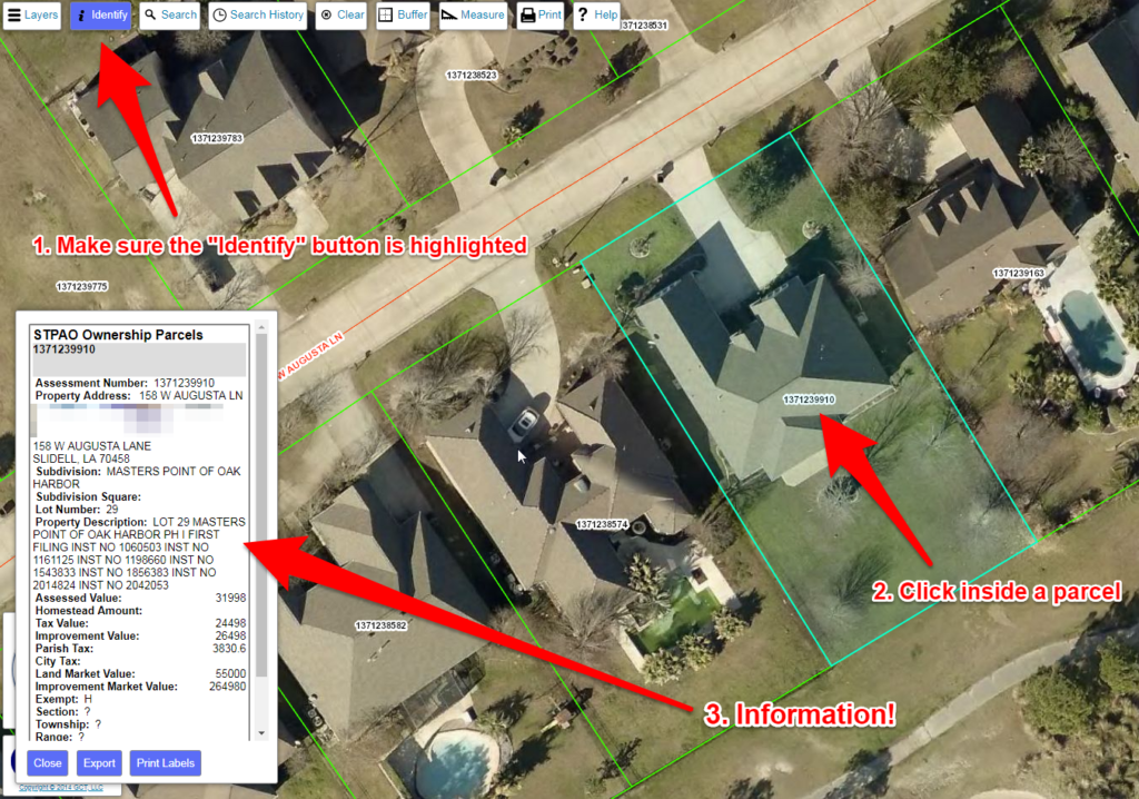
This functionality shortcoming should have been addressed in the current version of the parcel map. But if you ever find yourself clicking inside parcel boundaries on the map with no results, now you know to make sure the “Identify” button is active.
If you have questions and/or feedback for GIS that you’d like to see featured here in the future, please email me.