07 Jun On The Map: 2018-06
We are on the map! For the past five years, Tax District 14 has been off-limits to GIS here at the St. Tammany Parish Assessor’s Office. The City of Mandeville had its own GIS operation, and therefore we decided it best to leave the city to its own devices regarding parcel data.
Until now.
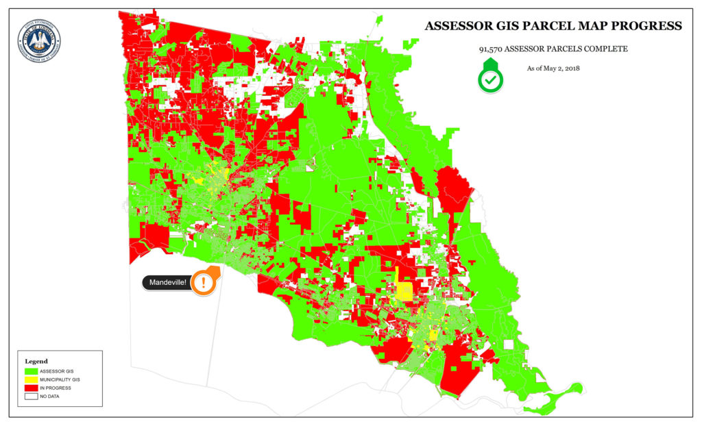
Mandeville, Tax District 14, is now on the Assessor’s Parcel Map.
Similar “off-limits” policies still are in effect for the municipalities of Covington and Slidell in terms of parcel data. But we plan on adding the Covington parcel data to our workload later this year if all goes well with the collection effort. Slidell is further out still and will be addressed after Covington.
To sum up, STPAO GIS now maintains the parcel data in-house for the City of Mandeville. That means you’ll see Mandeville parcel data online. If you see any data that looks wrong, have information about missing data, or have questions in general about the parcel map, please email me!
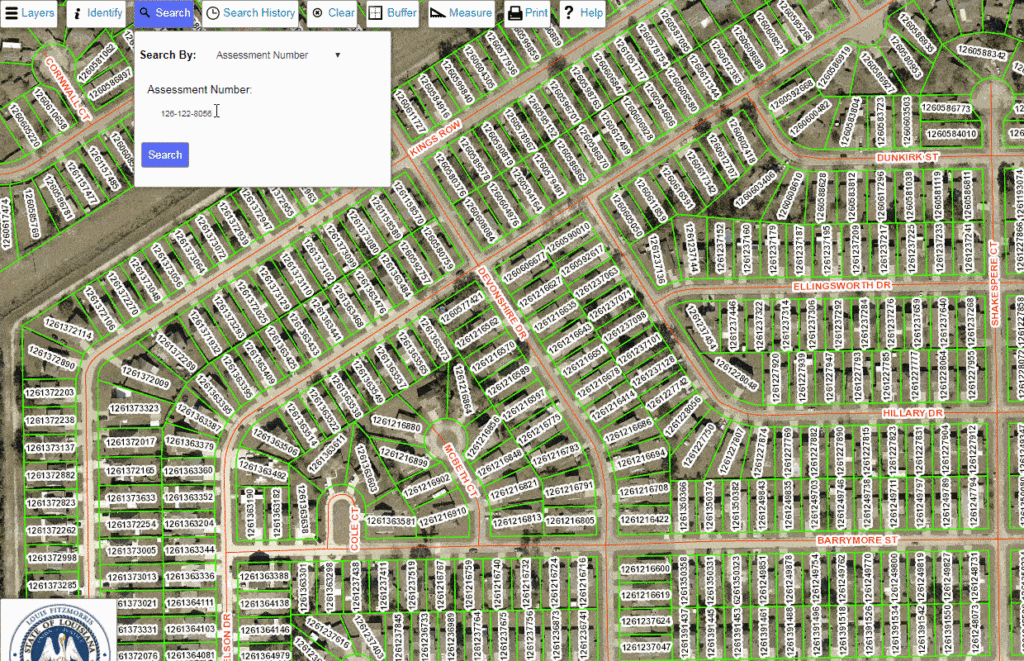
When searching by Assessment Number on the online parcel map, remember to remove the dashes from the Assessment Number. Otherwise, your search will return no results: