
07 May On The Map: 2018-04
Feedback, feedback, feedback.
We’ve gotten it in spades since putting the ownership parcels on the web by way of the online parcel map. Both from in-house users and from the citizens of St. Tammany Parish. Thoughtful, constructive, actionable feedback has played a big role in the ongoing development of this technology at the St. Tammany Parish Assessor’s Office, and I expect it to continue to do so as we move forward.
This series of newsletters has opened up a new channel for feedback to flow to the STPAO GIS Department from other departments, agencies, the public, etc. I’ve been using that information in part to build a “Frequently Asked Questions” document that can be previewed online now:
In addition to the FAQ we are building, GCT provides some documentation to help users understand the map. You can find that information on the map itself in the “Help” section:
Thank you, again, for sending your questions, concerns, suggestions, etc. regarding GIS and the online parcel map to the STPAO GIS department. We’re building something special for St. Tammany Parish with your help.
Keep sending that feedback!
SPEAKING OF THE PARCEL MAP …
Remember that issue we had with the “Identify” button in the first newsletter? Well, in addition to a few other upgrades, we took steps to address that functionality shortcoming recently.
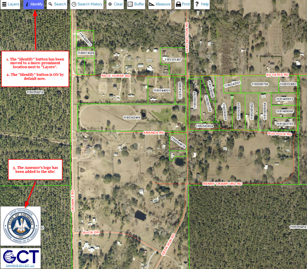
Now when the map is loaded for the first time, the “Identify” button is defaulted to the ON position. Also, it’s been moved closer to the “Layers” button, increasing its prominence on the site.
In addition, the Assessor’s logo has been added to the parcel map. The logo adds a touch of ownership to the online map, which has been one of Louis Fitzmorris’ big technology initiatives since becoming the Assessor. The logo is interactive, so clicking on it will open the Assessor’s main website in a new tab in your internet browser.