
14 Sep On The Map: 2018-09
The first directive given by the administration to the GIS Department was to focus ownership parcel collection efforts on the land south of Interstate 12. By way of a new reporting measure, it is quite clear where in the Parish STPAO GIS has been spending most of its time:
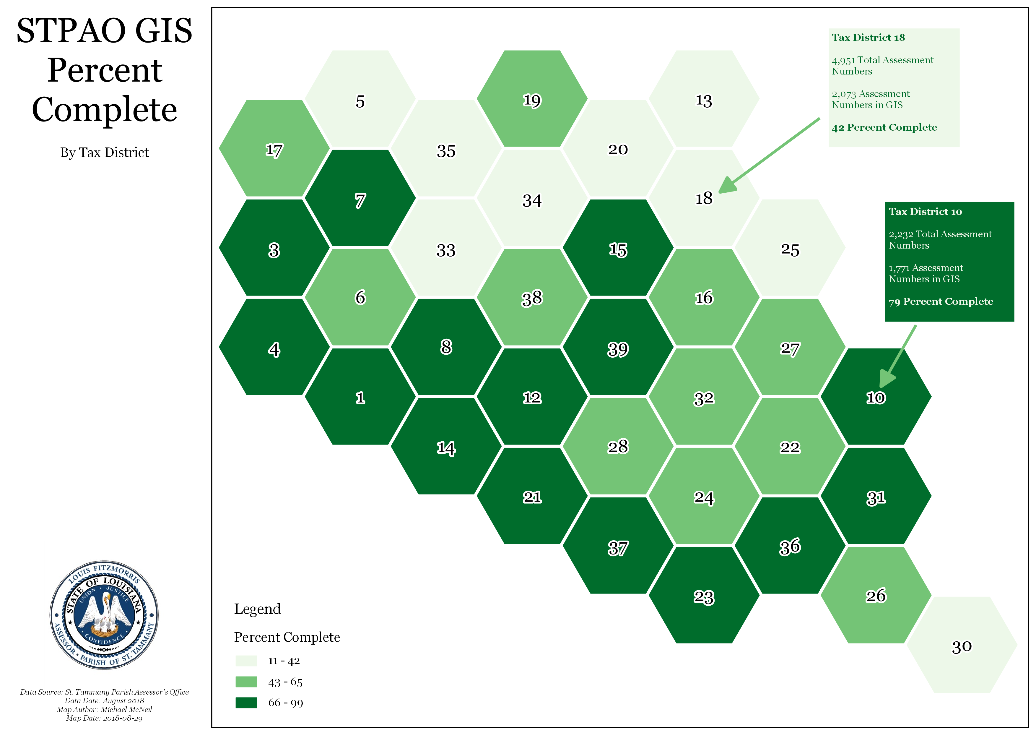
Looking pretty good in most of the Tax Districts south of I-12, except for Tax District 30!
So what’s going on there? An interesting anomaly, as TD30 only has five Assessment Numbers in the system. GIS has one drawn for a completion score of 20 percent.
USA LAND USE MAP
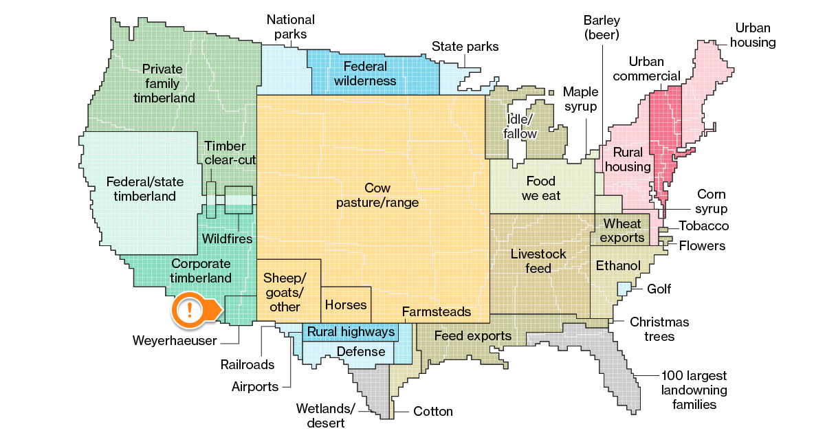
This land use map of the United States of America has been making the rounds on the internet. You can read more about it here.
I thought it was worth sharing here at the STPAO because there is an ownership connection to St. Tammany Parish: Weyerhaeuser, the company which owns large timber tracts in St. Tammany Parish, has so much timber land across the country that it was worth registering on the map!